
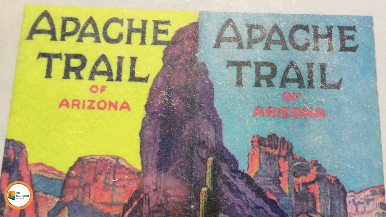
7 Scenic Stops on the Apache Trail Highway 88 Near Scottsdale, AZ |
Explore the breathtaking landmarks along Arizona's historic Apache Trail |
 |
 |
The Apache Trail, officially known as State Route 88, near Scottsdale, stretches approximately 40 miles from Apache Junction through the rugged terrain of the Tonto National Forest.
This historic route offers an intimate glimpse into Arizona's untamed desert landscapes, making it a favored excursion for residents of nearby Scottsdale.
Before embarking on this journey, it's essential to plan due to seasonal conditions and challenging terrains. |
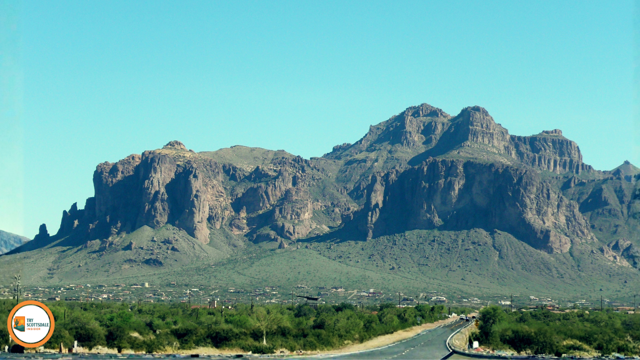 |
Scenic Stop 1: Superstition Mountains and Lost Dutchman State Park
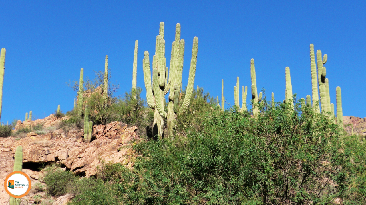
Lost Dutchman State Park graciously embraces the base of the awe-inspiring Superstition Mountains, offering a profound desert hiking experience amidst the stunning vistas near Scottsdale Community. The trails unveil rugged terrains and provide an intimate encounter with the diverse wildlife of the Sonoran Desert—javelinas, coyotes, and an array of birds.
Hiking Trails and Viewpoints
Many trails feature shaded benches at prime viewpoints, making them perfect for a pause. Photographers, take note—sunrise and sunset paint the mountains in magnificent golden-red hues.
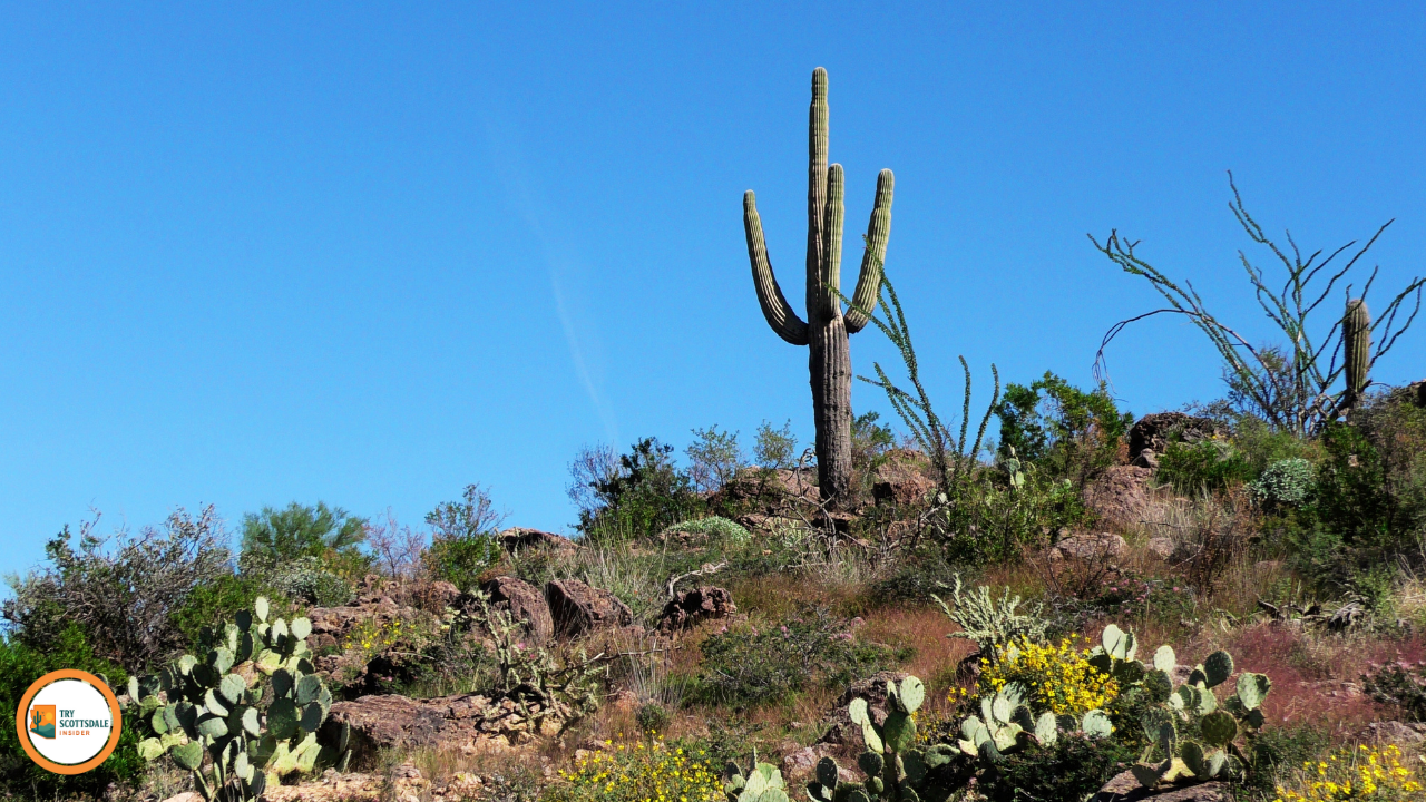
Wildlife and Flora The Superstition Mountains are brimming with hardy desert life resilient to the Sonoran heat. Javelinas frequently wander in small groups, often visiting campsites at dawn or dusk.
|
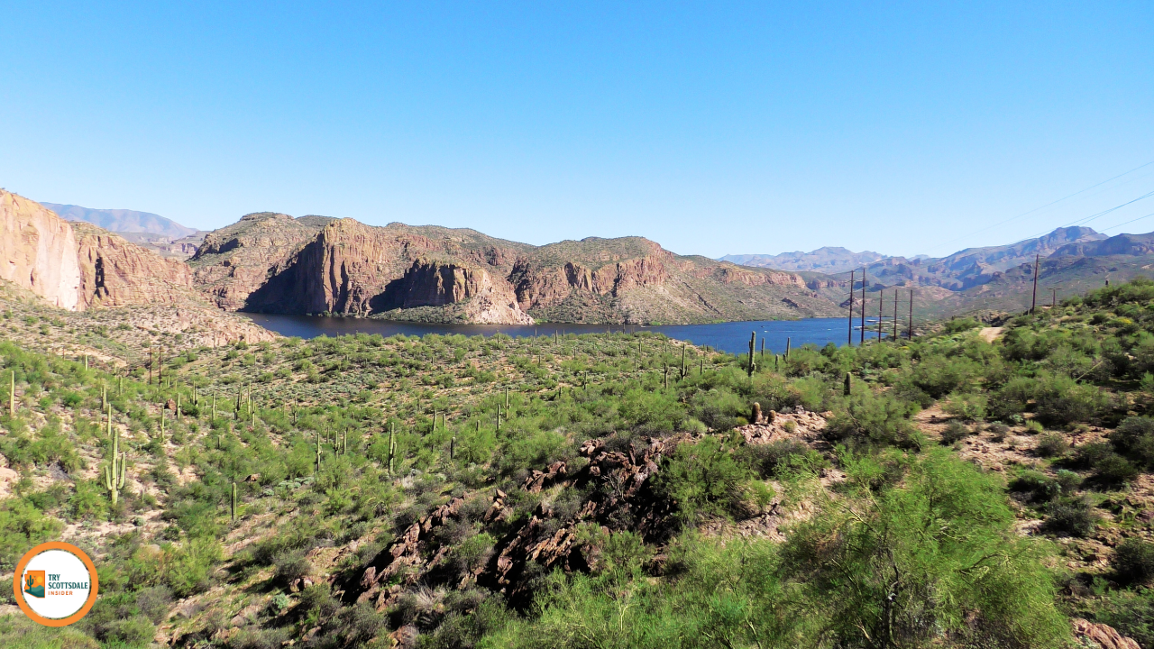 |
Scenic Stop 2: Canyon Lake Water Activities and MarinaThe Canyon Lake Marina is a haven for water enthusiasts on this expansive 950-acre reservoir. Rent a pontoon, fishing boat, or kayak right from the dock, open year-round. The crystal depths drop to 130 feet and remain surprisingly cool, even in summer. Spring and fall are excellent for bass fishing, with locals snagging 5-pounders from the depths.
Popular Water Activities include: The marina store covers all necessities—fishing licenses, bait, and snacks. Bring your own boat? They’ve got slips for rent. Boulder Canyon Trail AccessSet off on the Boulder Canyon Trail right from the marina parking lot. This moderate 6-mile round trip takes you through the untouched Sonoran Desert, offering epic views of towering saguaros and red rocks. Be lucky, and you might spot the occasional bighorn sheep! Highlights include:
Tip: Start early in summer to avoid the blistering heat of 100°F or more. Restrooms and water fountains are available at the trailhead, but always pack extra supplies. |
 |
Scenic Stop 3: Tortilla Flat and Surrounding Overlooks
Tortilla Flat is Arizona’s tiniest official community. on the Apache Trail, with just six residents. It’s quirky, historic, and surrounded by killer viewpoints of the desert and canyons—not far from Scottsdale Community adventures!
Historic Town Experience Tortilla Flat sits 18 miles northeast of Apache Junction on Highway 88. John Steinbeck even wrote about it back in the day, which is wild for such a tiny place.
The Tortilla Flat Country Store and Saloon is the main draw. It’s a restaurant, gift shop, and museum all rolled into one. The inside is covered with dollar bills—seriously, every inch.
Grab snacks, cold drinks, and classic diner food like burgers and chili. On a hot Scottsdale afternoon, the ice cream hits the spot.
Hours: 9:00 AM to 6:00 PM daily
The post office is just a tiny window inside the store. It’s one of the smallest in the country and kind of a fun photo op.
Nearby Scenic Pullouts Within two miles of Tortilla Flat, you’ll find several pullouts along the Apache Trail. They’re perfect for snapping photos of the Superstition Mountains and desert vistas that Scottsdale Community loves.
The Canyon Lake Overlook is a mile east of town. You get a sweeping view of the lake from 200 feet above—enough parking for about 10 cars.
Geronimo Head Lookout looks down on the desert valley. Early settlers thought the rock formation resembled a Native American profile, hence the name.
There are two more pullouts nearby, both with clear views of saguaros and maybe some wildlife. If you’re into photography, hit these spots between 7:00 and 9:00 AM for the best light. |
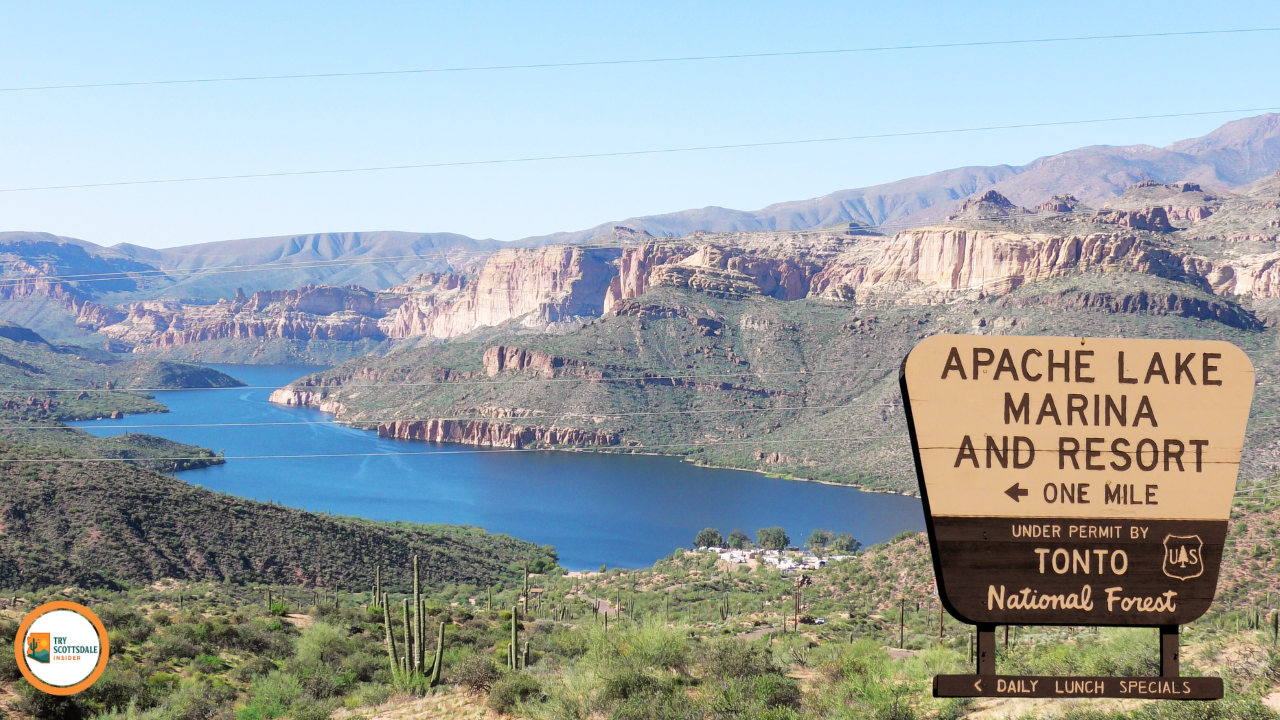 |
Scenic Stop 4: Apache Lake
Apache Lake is a top spot for boating and fishing along the Salt River, with camping and a few dining options for folks road-tripping the Apache Trail from Scottsdale. The lake sits at 1,900 feet, surrounded by mountains, and stretches out over 2,568 acres when full.
Boating and FishingApache Lake is a boater’s dream—deep water, sheltered coves, and plenty of space for skiing or wakeboarding. Recreational boaters from Scottsdale Community make this a regular weekend escape.
Launch your boat at the Apache Lake Marina, which has a concrete ramp and a courtesy dock. The marina rents pontoons, fishing boats, and jet skis during the busy season. Bass fishing is solid all year. Largemouth, smallmouth, and white bass are all here. The best spots?
Catfish and carp are around, too. Spring and fall are the best times to fish, especially for Scottsdale anglers looking for a break from city life.
Apache Lake CampgroundThe campground hugs the shoreline and has 35 developed sites. Most have picnic tables, fire rings, and restrooms with showers—pretty comfy for being out in the wild. Sites 1-15 have the best lake views and direct water access. These fill up fast on weekends and holidays. Sites 16-35 sit farther back but still make it easy to hit the water. The campground works on a first-come, first-served basis from October through April. If you’re coming in the summer, reserve ahead through the Tonto National Forest system.
Dining and Lodging OptionsThe Apache Lake Marina Store stocks the basics—snacks, drinks, fishing gear, ice, propane, and camping stuff. They’re open seasonally, March to October.
For a real meal, drive back to Tortilla Flat, about 15 miles west. The Tortilla Flat Restaurant is famous for chili burgers and prickly pear ice cream—a Scottsdale Community favorite.
Need a bed? Roosevelt Lake Resort, 12 miles east, is your best bet. They’ve got cabins, RV sites, a restaurant, a general store, and boat rentals.
There are a handful of hiking trails starting from the Apache Lake area, including routes to old cliff dwellings and scenic overlooks. The Apache Trail keeps going east to Roosevelt Dam, with even more stops along the way. Scottsdale adventurers, you’ll want to keep exploring. |
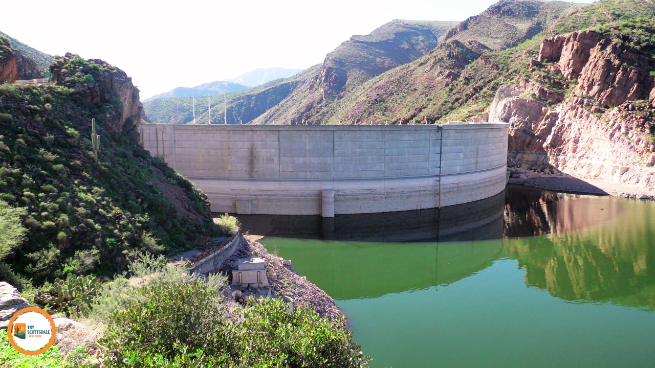 |
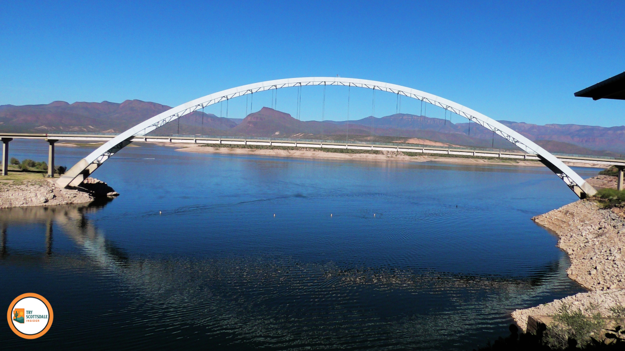
Scenic Stop 5: Roosevelt Dam and Roosevelt Lake
Roosevelt Dam stands out as a historic engineering marvel in the heart of Tonto National Forest. This spot created Arizona’s largest lake, right where you’d least expect it.
The area around Roosevelt Dam offers all kinds of water activities and fishing spots. You’ll find scenic viewpoints that are just begging for a photo, or maybe just a quiet moment to soak it all in.
History of Roosevelt DamTheodore Roosevelt Dam was completed in 1911, and at the time, it was the world’s largest masonry dam. It towers 280 feet above the Salt River and stretches an impressive 1,210 feet across the canyon.
President Theodore Roosevelt himself dedicated the dam in 1911, saying it was a crucial piece of his conservation vision. Building this thing took six years, and workers had to get creative in the wild Arizona backcountry.
They hauled materials by wagon and mule train through some rough desert terrain. The dam’s rubble masonry came from local quartzite stone—pretty old-school, honestly.
In 1996, the Bureau of Reclamation decided to modernize things, adding concrete and raising the dam by 77 feet. That move doubled Roosevelt Lake’s storage capacity to nearly 3 million acre-feet of water.
The dam now provides flood control, water storage, and hydroelectric power for central Arizona. It’s really the backbone of the Salt River Project’s water delivery system, keeping Scottsdale Community and beyond hydrated. Water Recreation on Roosevelt Lake
Roosevelt Lake covers up to 21,500 acres when it’s full, making it Arizona’s largest lake. It sits at 2,100 feet, wrapped by the Tonto National Forest and not too far from Scottsdale Community.
Popular water activities include:
Bass fishing is especially good near the submerged creek channels and rocky points. Spring and fall? That’s when the water temps are just right for catching the big ones. There are several boat ramps scattered around the lake. The main one is near Roosevelt Dam itself, with concrete docks and a big parking area.
Water levels rise and fall depending on the season and water demands. In summer, the water drops, so you’ll see more rocky shoreline than you might expect.
Viewing Points and Picnic AreasRoosevelt Lake Vista Point gives you those sweeping, panoramic views of the lake and the surrounding desert mountains. You’ll find it along Highway 88, just past the dam crossing.
|
 |
Planning your Apache Trail Adventure from Scottsdale promises an unforgettable journey through the stunning Superstition Mountains. Before you set out, be prepared with a few essential tips to ensure a smooth trip. Recommended Itineraries:Half-Day Trip (4-5 hours)
Full-Day Adventure (8-10 hours)
Overnight Experience
Safety Tips and Trail Preparation:Vehicle Requirements
Weather Considerations
Emergency Supplies
Inform someone of your route and expected return time, especially when venturing from the Scottsdale Community into new areas. Road Trip Essentials:Navigation Tools
Photography Gear
Comfort Items
Embark on your Apache Trail Adventure with these essentials in mind for a truly memorable experience! |
 |
What are the top stops to visit along the Apache Trail?
Exploring the Apache Trail in Arizona is an absolute treat for nature lovers and adventure seekers alike! This famous route is packed with stunning vistas, historic sites, and unique attractions.
Here are some must-visit stops along the trail:
Each stop along the Apache Trail offers its own slice of Arizona's vibrant past and picturesque beauty. Make sure to bring your camera and a sense of adventure! |
How long is the drive on the Apache Trail from start to finish?
The Apache Trail is one of those scenic drives that can be described as both breathtaking and adventurous. But how long does it actually take to traverse the route from start to finish?
Well, here’s the scoop for all you road trip enthusiasts:
Remember: Some portions of the trail are unpaved and winding, so be prepared for a true adventure. Enjoy the ride and drive safely!
|
 |